How to Use Offline Maps for Navigation During Remote Adventures
When venturing into the great outdoors for a remote adventure, having access to reliable navigation is crucial. While relying on GPS and online maps may seem like the go-to option, there may be areas with poor network coverage, leaving you stranded without a map. This is where offline maps come in handy. Here’s how you can use offline maps for navigation during your remote adventures.
Step 1: Download an Offline Maps App
Before heading out on your remote adventure, make sure to download an offline maps app on your smartphone or GPS device. There are several apps available that offer downloadable maps for different regions. Some popular offline maps apps include Maps.me, OsmAnd, and Gaia GPS.
Step 2: Download Maps for Your Desired Area
After downloading the offline maps app, you will need to download the maps for the specific area you will be exploring. This can usually be done by selecting the region or area within the app and downloading the map for offline use. Make sure to download maps for all the areas you plan to visit during your adventure.
Step 3: Plan Your Route
Once you have downloaded the offline maps for your desired area, it’s time to plan your route. Use the offline maps app to mark key points of interest, trails, campsites, and any other important locations along your route. This will help you stay on track and avoid getting lost during your adventure.
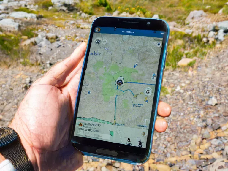
Step 4: Use the Offline Maps for Navigation
During your remote adventure, rely on the offline maps app for navigation. Even without an internet connection, the offline maps will still show your location in real-time, helping you navigate through the terrain safely. Make sure to regularly check the map to ensure you are on the right track.
By following these steps and utilizing offline maps for navigation during your remote adventures, you can explore the great outdoors with confidence and peace of mind.